Remote Mowers for Drainage Ditches
Drainage-ditch mowing is shaped by ditch depth, bank angle, soft ground and the space available for recovery. Measure both the bank and approach route before selecting a mower.
Direct recommendation
For drainage ditches, measure the full cross-section and choose whether work occurs from the bank, side slope or bottom under approved conditions. Send MERI the measured site profile before the final remote mower configuration is fixed.
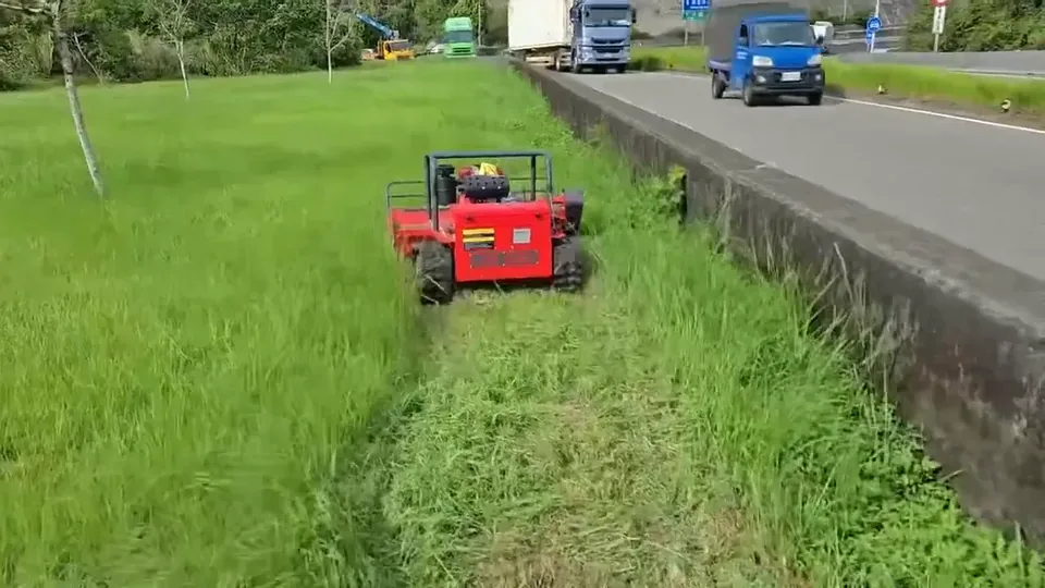
Start with the work zone
Draw the ditch as a series of banks, crossings, culvert entrances and access shoulders. Identify where the operator can see the cutting edge and where the machine has a route out. A ditch cross-section may change substantially along a short length.
Site data to collect
Measure the usable bank strip, side slope and turning space at bridges or crossings. Record water, soft shoulders, covers, debris and uneven bottoms. Include the ditch profile in photographs so machine width can be compared with stable ground rather than the full channel opening.
Measure terrain and access
Record typical and maximum slope with the measuring method and intended travel direction. Measure the narrowest gate or row, overhead clearance, headland, turning radius, loading ramp, bridge and storage entrance. Compare these values with the complete machine, not cutting width alone.
Classify the vegetation or material
State species where known, height, density, moisture and representative stem diameter. Separate routine grass maintenance from first-pass reclamation, reeds, brambles and woody material. Identify wire, stone, litter, roots and other hidden hazards before cutting.
Choose the working system
Specify maintained grass, reeds or woody regrowth separately. Define vegetation clearance without asking the cutting system to contact culvert walls or other drainage assets. Sections requiring an offset tool or another method should be identified in the task brief.
Plan the safe work method
Define operator position, visibility, exclusion zone, communication, stop conditions and recovery. Follow the delivered instructions, site-owner controls and applicable local rules. Remote control changes where the operator stands; it does not remove site hazards.
Account for changing conditions
Rain, heat, vegetation moisture, soil strength and public or traffic activity can change the acceptable route. Write objective stop rules for loss of visibility, slip, rutting, unstable edges, hidden debris or third-party entry.
Compare configurations with one matrix
| Decision | Evidence |
|---|---|
| Access | Measured width, height, turns and transport route |
| Terrain | Slope, direction, transitions, surface and edge stability |
| Working system | Material class, finish, debris and compatible attachment |
| Power | Duty cycle, refuel/charge access, noise and service plan |
| Release | TDS, quotation, site plan, method and responsible approval |
Validate before full deployment
Compare one accessible section with its entry, cutting route and exit included. Record visibility gaps, stopping points and remaining vegetation around structures. Inspect drainage paths after the work so the mowing result can be assessed alongside the ditch-maintenance purpose.
Buyer information pack
- Marked site plan and zone measurements.
- Representative vegetation/material and ground evidence.
- Required finish, frequency and daily work window.
- Transport, storage, refuel/charge and service arrangements.
- Destination, document needs and exact quotation contact.
Buyer FAQ
Can one slope or width number select the machine?
No. Selection uses the complete route, surface, vegetation, hazards, work cycle and required result.
Does remote control remove the need for a site plan?
No. The site plan defines operator position, exclusion zones, stop conditions and recovery.
What confirms the final specification?
The current product documents and final quotation for the exact ordered configuration.
Build a site-specific shortlist
Send measurements and representative media for drainage ditches.