Centimetre-Level Positioning
Dual GNSS antennas and an RTK correction reference give the controller position and heading data for accurate path tracking in RTK fixed-solution mode.


1 / 6
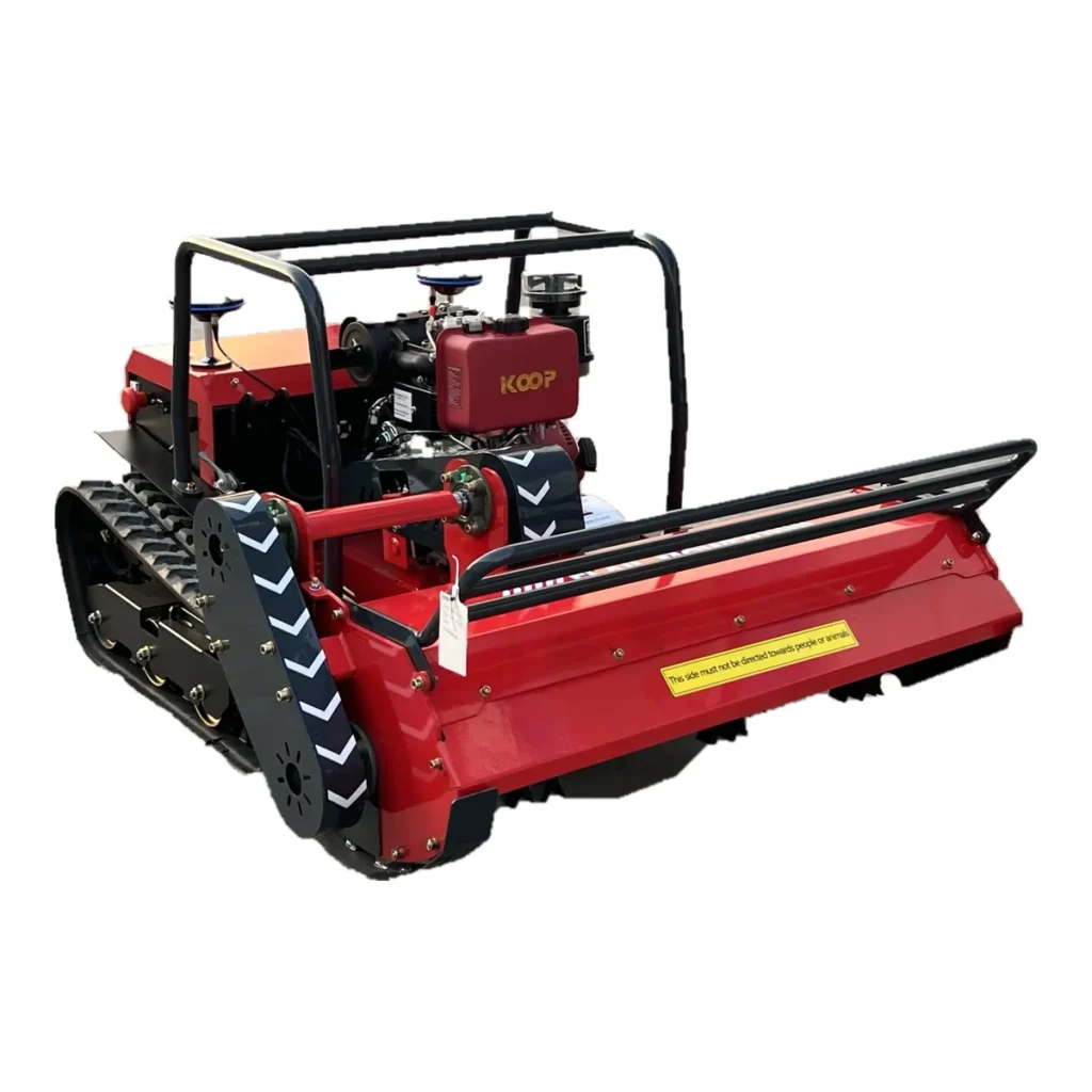
Shown: a MERI diesel remote mower with dual RTK GNSS antennas installed, plus example option hardware. Delivered components follow the confirmed configuration list.
MERI · Navigation & control upgrade
Add guided coverage to a suitable MERI remote control mower or field machine. The RTK navigation controller plans zigzag, spiral, custom and orchard routes, tracks them with centimetre-level positioning in RTK fixed-solution mode, and can resume an interrupted job.
Start with the Standard RTK package for open, regular sites. Add stereo vision, 3D LiDAR, a large-screen remote terminal or an RTK base station when the site and task call for them.
Navigation is an optional upgrade, not standard on every MERI machine. MERI works with specialist technology partners on navigation systems and is your contact for selection, integration and support.
What the system does
Dual GNSS antennas and an RTK correction reference give the controller position and heading data for accurate path tracking in RTK fixed-solution mode.
Choose zigzag (back-and-forth), spiral, custom recorded routes or orchard routes that connect and edit points between tree rows, reducing repeated passes over finished ground.
Record fixed obstacles and a return point when mapping. Pause, stop or recall the machine from the app, and resume a stored job where it stopped.
Three packages. One selection logic.
Select by obstructions, satellite visibility and task complexity—not by the longest sensor list. Standard, Advanced and Flagship are package names; the enabled hardware and functions follow the confirmed configuration list.
For open, regular fields, parks and sites with good sky view. Focused on stable operation, cost efficiency and straightforward integration.
Typical work: regular mowing, site spraying or cleaning, routine inspection, low-speed transport.
For tree cover, partial obstructions, weaker satellite reception, modest terrain change and irregular areas. LiDAR data corrects positioning deviations and improves continuity.
Typical work: orchards, woodland edges, complex fields, municipal and park work.
RTK, LiDAR SLAM, inertial navigation and further sensors for indoor/outdoor transitions, 3D scene mapping, route memory and continuous multi-environment tasks.
Typical work: complex sites, indoor/outdoor transport, customized projects.
| Package | Positioning | Best-fit environment |
|---|---|---|
| Standard | High-precision RTK | Open, regular outdoor areas |
| Advanced | RTK + LiDAR SLAM fusion | Trees, partial obstructions, irregular layouts |
| Flagship | RTK + LiDAR SLAM + inertial & multi-sensor fusion | Indoor/outdoor transitions, complex continuous tasks |
Optional modules
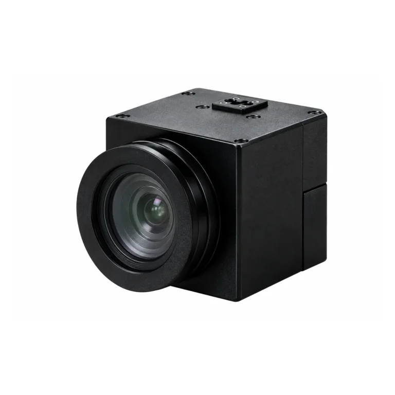
Stereo cameras detect moving obstacles. Combined with marked fixed obstacles, the system can avoid, slow down or stop. Video transmission helps the operator observe the work site.

Touch-screen terminal for machine control, parameter adjustment, custom task settings and manual intervention. Standalone offline operation depends on the supplied configuration.
3D mapping, terrain scanning, obstacle ranging and perception. With the appropriate SLAM configuration and a valid map, it supports localization where satellite reception is obstructed.
Differential-positioning reference for the machine: up to 2.5 km radius (5 km diameter) in open areas, 20 dBm transmit power, DC 5 V supply. Actual coverage depends on terrain, obstructions and radio conditions.
Obstacle detection depends on mounting, object characteristics and the environment. Avoidance strategy, range and sensitivity are configured for each project.
How a job is set up
Automatic low-battery return and post-charge resumption apply only to electric machines with compatible automatic charging hardware and require separate confirmation.
Source-stated nominal figures
| Item | Specification |
|---|---|
| Satellite systems | GPS + BeiDou (BDS) + GLONASS |
| Position accuracy | ±2 cm in RTK fixed-solution mode |
| Attitude accuracy | 0.1°, 6-axis IMU |
| Position update rate | 10 Hz |
| Differential reference | RTK base-station support |
| Base-station coverage | ≤2.5 km radius / ≤5 km diameter, open area |
| Route types | Zigzag, spiral, custom, orchard |
| Controller interfaces (NAV-L3) | Power/data connector, RJ45 Ethernet, 4G, Wi-Fi, Bluetooth, dual GNSS antenna ports, Nano-SIM |
| NAV-L3 controller size | 114.4 × 66.2 × 29.3 mm (body) |
Actual accuracy varies with installation, correction service and positioning conditions; confirm it with the supplied hardware and a site acceptance test. Power supply and wiring are confirmed per delivered harness before installation.
Navigation does not replace the emergency stop, exclusion zones or trained supervision. Read the comparison of RTK, vision and LiDAR navigation and standard remote vs navigation-assisted mowers before you specify a system.
Remote control mowers and brush cutters in parks, regular fields and orchards with mapped, repeatable passes.
Compatible sprayers, compact tillers and other low-speed field equipment in regular or complex plots.
Patrol, inspection and transport projects, plus vehicle-interface adaptation and software extensions for OEM builds.
Step-by-step demonstration
The tutorial shows one configuration. Screens and controls vary with the delivered hardware and software version. More demonstrations in MERI videos.
Technical consultation, feasibility assessment and solution configuration before purchase; commissioning guidance, operator training and software-update coordination after delivery.
The NAV-L3 English user manual is shared with buyers and project partners on request.
Request the NAV-L3 user manual →No. MERI machines are standard with direct remote control. RTK navigation is an optional upgrade for suitable machines and sites, confirmed in the quotation.
The source specification is ±2 cm in RTK fixed-solution mode with a 10 Hz update rate. Real accuracy depends on installation, correction source and site conditions, so it is confirmed in a site acceptance test.
Fixed obstacles are recorded on the map and routed around. Detection of moving obstacles needs the optional stereo-vision camera or 3D LiDAR, with avoidance, slowing or stopping configured for the project.
Tree cover can weaken satellite reception. For orchards and partially obstructed sites, the Advanced RTK + LiDAR SLAM package is recommended, with performance confirmed on site.
An RTK correction reference is required. MERI can supply an optional base station covering up to 2.5 km radius in open areas; the right source depends on your site and region.
Integration is possible for compatible low-speed equipment after reviewing the vehicle, control interfaces and site. Send the details for a feasibility assessment.
Tell us about your machines and sites. MERI will recommend the navigation package and options, and quote the matched configuration for dealers, contractors and OEM projects.